measure allowing to retrieve shapes at a given distance of measured shape
This measure allows to collect index and distance of neighbors of a shape given a user parameter distance threshold MaxDist (we collect shape indexes for which distance is lower or equal to this value). It is based on a geometric analysis of shape neighborhood.
Meshes associated to shapes are currently extremly dense. In consequence distance from a shape triangle to another shape is defined has minimum distance between its barycenter and barycenters of the triangles of the other shape.
Parameter flag ProcessHoles allows to specify whether shape holes should be taken into account during computation. Please see Distance to nearest neighbor 2d for an explanation of effects of this flag.
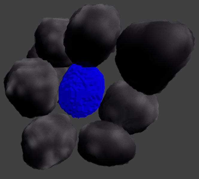
Given an input shape (in blue) with neighbors (in grey) :
We collect indexes of neighbors at a given distance of considered shape :
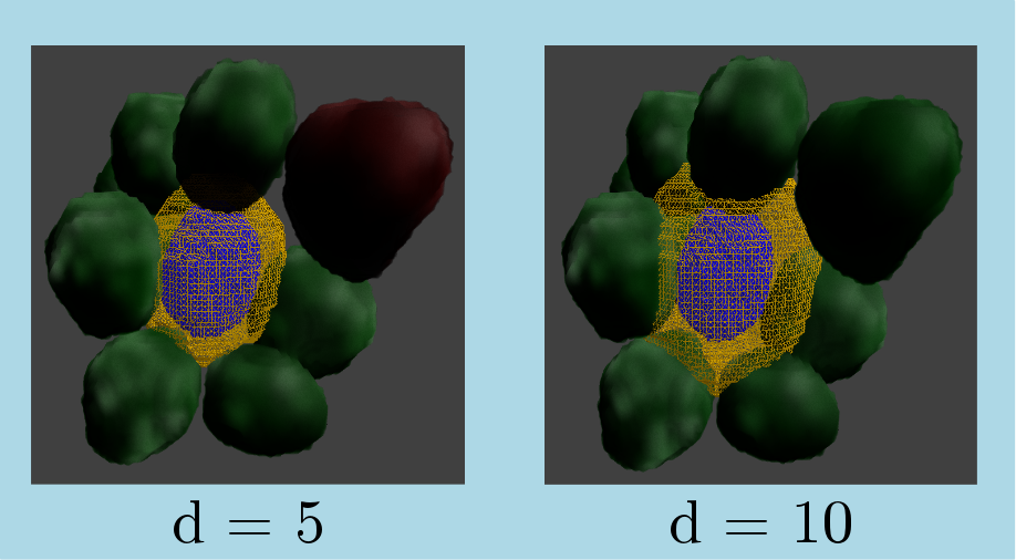
On previous figures :
- yellow wireframe represents the isosurface at given distance of shape (so we keep neighbor shapes with intersection with this volume)
- green shapes are shape for which associated distance is lower or equal to requested distance
- red shapes are associated to a distance greater than requested distance an will be excluded
Here is an example of number of nearest neighbors computation for a sample of shapes :
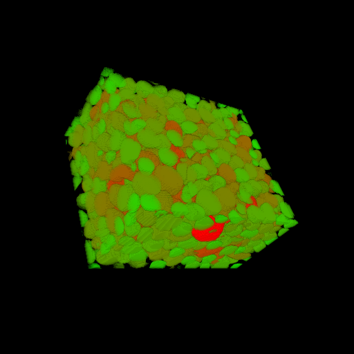
On previous figure, number of collected nearest neighbors is illustrated using a color map starting on green colors for fewer number of neighbors and ending on red color for higher number of neighbors.
measure allowing to retrieve shapes at a given distance of measured shape
Measure synthesis :
Measure Type | Measure Unit Type | Parameter Type | Result Type | Shape Requirements |
Geometry 3d
|
None
|
NearestNeighbors3dMsrParams |
Custom
|
Boundary Approximation
|
See Shape measurement for additional information on these pictograms Example of Python code :
Generic example in 3d case :
import PyIPSDK
import PyIPSDK.IPSDKIPLShapeAnalysis as shapeanalysis
inMeasureInfoSet3d = PyIPSDK.createMeasureInfoSet3d()
PyIPSDK.createMeasureInfo(inMeasureInfoSet3d, "NearestNeighbors3dMsr")
outMeasureSet = shapeanalysis.labelAnalysis3d(inGreyImg, inLabelImg, inMeasureInfoSet3d)
PyIPSDK.saveCsvMeasureFile(os.path.join(tmpPath, "shape_analysis_results.csv"), outMeasureSet)
outMsr = outMeasureSet.getMeasure("NearestNeighbors3dMsr")
outMsrValues = outMsr.getMeasureResult().getColl(0)
print("First label measurement equal " + str(outMsrValues[1]))
Example of C++ code :
Example informations
Associated library
IPSDKIPLShapeAnalysis
Code Example
ImagePtr pInGreyImg3d =
loadTiffImageFile(inputGreyImgPath, eTiffDirectoryMode::eTDM_Volume);
Shape3dCollPtr pShape3dColl = boost::make_shared<Shape3dColl>();
IPSDK_REQUIRE(readFromBinaryFile(inputShape3dCollPath, *pShape3dColl) == true);
MeasureInfoSetPtr pMeasureInfoSet = MeasureInfoSet::create3dInstance();
createMeasureInfo(pMeasureInfoSet, "NearestNeighbors3dMsr", createNeighborsDistanceMsrParams(maxDist, bProcessHoles));
MeasureSetPtr pOutMeasureSet =
shapeAnalysis3d(pInGreyImg3d, pShape3dColl, pMeasureInfoSet);
const MeasureConstPtr& pNearestNeighbors3dOutMsr = pOutMeasureSet->getMeasure("NearestNeighbors3dMsr");
const NearestNeighborsMsrResults& outResults = static_cast<const NearestNeighborsMsrResults&>(pNearestNeighbors3dOutMsr->getMeasureResult());